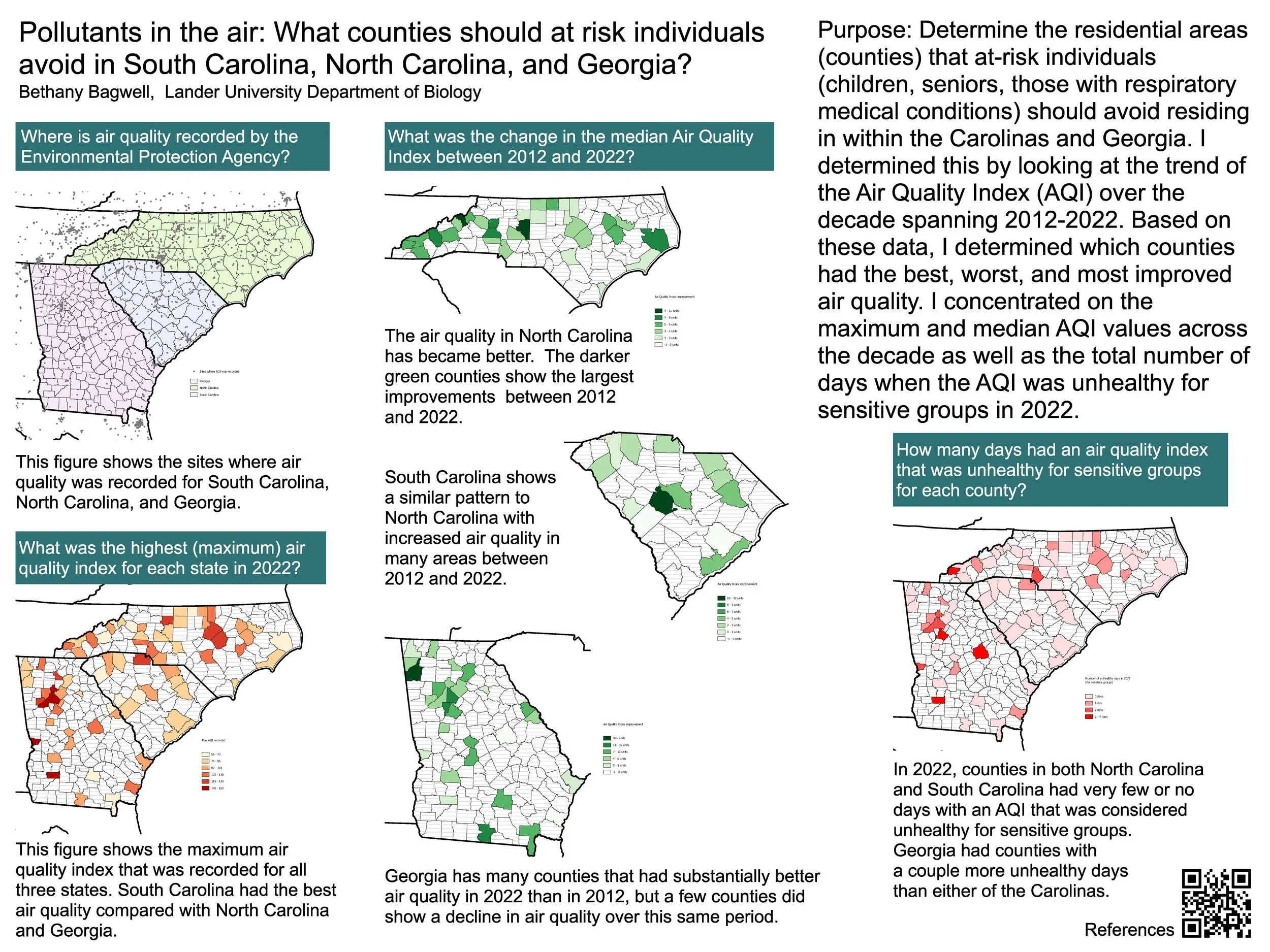
Pollutants in the air: What counties in South Carolina, North Carolina, and Georgia should at risk individuals avoid taking residence in?
Bethany Bagwell
Air quality is a topic of concern for at risk groups such as children, the elderly, and those with respiratory or autoimmune conditions. However, the knowledge of which areas which those at risk individuals should avoid may not always be readily accessible. At any given time, there are various amounts of criteria gases which can negatively affect at risk individuals. These include carbon monoxide (CO), lead (Pb), ground-level ozone (O3), particulate matter (PM), nitrogen dioxide (NO2), and sulfur dioxide (SO2). These criteria gases are outlined by the Environmental Protection Agency (EPA) as the six most common air pollutants. The EPA publishes annual data regarding the air quality numerical rating and whether or not the air quality is considered ‘good’ or not for each county across the United States. These data are collected from multiple air quality reporting sites within each county to report a numerical value. However, there are many data points which are difficult to interpret. By taking the average of all points in each county in South Carolina, North Carolina, and Georgia, and comparing it to the average data collected within the previous decade, I determined which counties would be considered safe for at risk individuals, and which they should avoid. Using QGIS technology I mapped the air quality index data gathered by the EPA on the counties in South Carolina, North Carolina, and Georgia so that this information could be easily accessible and understandable for affected individuals.
Bethany Bagwell is a biology major with a genetics emphasis and minors in chemistry and political science. She is a student in the Honors College and a member of the Honors College Leadership Council, the Pre-Health Club, and the Anime-niacs. After graduation, she plans to go to graduate school to prepare for a career in cancer research.
